



Binger Loch and Nahe Water Gap Rhine Valley, Nahe water gap, Rochusberg
Near Bingen, the Rhine suddenly changes its course and winds its way through the mountains.
How did this happen?
The River Nahe took the difficult route through the Rochusberg hill.
Why did it not flow around the hill in the south?
This landscape documents the ups and downs of 350 million years of geological activity, mountain building, erosion, peneplain formation and the erosive forces of a river. Let us solve this puzzle step by step.
Young mountain ranges are characterised by steep jagged peaks. However, here in the Rhenic Slate Mountain Range the hills are gentle. Only the valley walls are steep here and the mountains tops are flat. But why? A huge mountain range was formed here during the Carboniferous period (360-300 million years ago). Up to the Lower Tertiary Period these peaks were denuded to form a plain. The rest of this so-called peneplain form the level tops of the Hunsrück and Taunus today, which are usually found above 400 m..
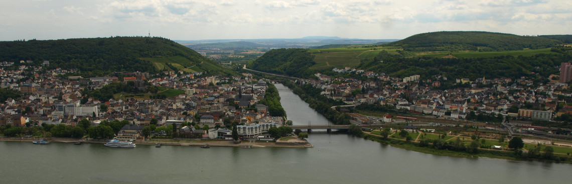
In the field-of-view of the stele Bingen and the Nahe water gap. The River Nahe separates the Rochusberg from the Münsterer Kopf. The level top of the Rochusberg is an old river terrace formed by the Rhine. The gentle slope of the terrace is the result of the uplift of the mountain range. The level top of the Rupertsberg is an ancient Nahe river terrace.
The Primeval Rhine
Around 30 million years ago, the north and south seas were linked by a shallow channel that ran between Bingen and Bonn. Later the Primeval Rhine used this strait.
During the Quaternary Period (2.6 million years ago until today) the Upper Rhine Graben and Mainz Basin were downdropped while, at the same time, the Slate Mountains were uplifted. The Rhine faithfully remained in its old channel through the hard rocks of the mountains. While the mountains were uplifted the river carved its bed deeper into the rocks, forming a so-called water gap, the Middle Rhine Valley of today.
Quartzite soils are debris soils.
Ice age frost shattering broke the rock into rough blocks, stones and sand. The sandy and stony quartzite debris soils are dry and nutrient-poor. However, the shales between the layers of quartzite have been weathered to a fine clay. Iron oxides produce the typical reddish colour of these mineral-rich soils.
The poor quartzite soils are improved significantly when they become mixed with the clay soils and the wind-blown loess deposits.
The River Nahe followed the Rhine
Then River Nahe could have avoided the hard quartzite of the Rochusberg if it had taken the detour via Gaulsheim.
So why didnt the river flow around the mountain? Captured in its bed, the Nahe was forced to follow the course of the Rhine.
Thus the Rochusberg is a quartzite mountain separated from the Rhenic Slate Mountains. At the beginning, both Rhine and Nahe flowed over the top of this mountain. As the Rhine carved its valley deep into the Slate Mountains the Nahe was also trapped in its rocky bed and had to follow suite, creating the Lower Nahe Valley water gap.
Vineyard sites
The steep slopes of the Rüdesheimer Berg face the south. The maximum gradient is 60 degrees. Solar radiation and the amount of heat received by the slopes is one of the highest in the Rheingau. The soils have developed on quartzite mixed with reddish slate. The rocky soils are excellent heat retainers.
The vineyard Berg Schlossberg (= Castle Hill 25.3 ha) was named after the defensive and toll castle Ehrenfels. The vineyard produces spicy, very long Rieslings with a balanced acidity.
The vineyard Berg Kaisersteinfels (8.2 ha) recalls the name of Charlemagne, for whom, in the 9th century, this vineyard was stocked with the variety Orleans. This site produces wines with a notable minerality and acidity.