



On the Fürstenkopf Varied Slates, Assmannshausen, Castle Rheinstein
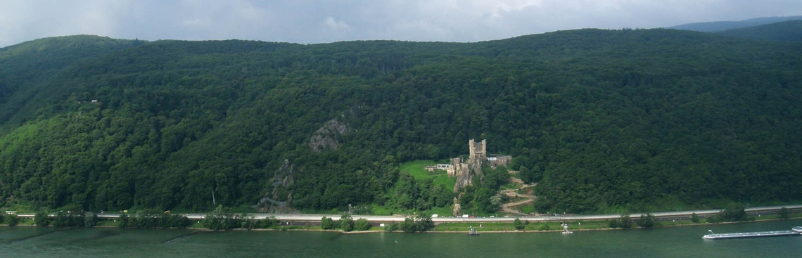
In the field-of-view of the stele
You can see two quartzite crags. One of these is crowned by the Castle Rheinstein. The stele itself is located on the counterpart of this crag on the right side of the Rhine. In the forest you can also see a step in the slope, a level area, which stretches to Trechtingshausen an old river terrace of the Rhine. Tectonic forces tipped these beds sideways, so that shale and quartzite, once deposited one over the other, are now found next to each other.
The landscape of the Varied slates
Just like the grey crag on the opposite side of the Rhine, the ridge behind you is composed of a particularly hard rock: quartzite. Sandwiched between the quartzite beds is the very soft, foliated, reddish-violet slate. The alternating sequence of quartzite and slate is typical for the geological formation known as the Varied slates. These rocks were formed during the Lower Devonian. The Varied slates underlie the landscape here on the eastern slope of the Rhine Valley.
The fine substrate (clay) of the slates was deposited in the quiet waters of the deep ocean, whereas the coarser material (sand) of the quartzites was deposited in the more turbulent shallow ocean.
The alternating sequence of rocks produces a characteristic landscape: the erosion of the soft slates has left the hard quartzite beds exposed in the form of steep cliffs. Very little soil has formed on these sites, which are usually covered with forest. Wherever slate underlies an area, the terrain is less steep and covered by deep soils. These are the areas used for viticulture.
Bad Assmannshausen
Lithium containing thermal springs are located near the foot of the slope, and in some cases, even in the river bed of the Rhine. In 1870, the water from these individual springs was collected to form the Graf Adolf Spring and bottled as spa water. Bad Assmannshausen was a recognized spa town until 1939.
Castle Rheinstein
Because of its imposing rocky location Castle Rheinstein became the symbol of the romantic initiative to restore the castles along the Rhine.
First officially recorded in 1279, the castle was built to collect tolls and protect the Mainz Territory against marauding knights. The castle fell into ruins in the 17th century. Friedrich Wilhelm Ludwig von Preussen bought the ruins in 1823 and, inspired by the Rhine Romanticism of the 19th century, restored the castle.
The castle belonged to the Hohenzollern dynasty until 1975, when it was sold to the Family Hecher.
Settled alluvial fans
The old settlement centres are located on the alluvial fans of the tributaries, some distance from the Rhine itself. Thus the town centre of Assmannshausen is located on the alluvial fan of the Höllenbach. Alluvial fans were formed during the last ice age as the velocity of the streams and therefore their capacity to transport loads, was reduced when they joined the Rhine.
Vineyard sites
The name Höllenberg (Hell Hill, 45 ha) is derived from the Middle High German word for very steep slope. This steep location with gradients between 30 and 60% mainly comprises the warm south flank of the Höllenbach Valley. The stony and coarse soil has developed on scree and weathered shale debris. The clay-rich shale soils produce rich, full-bodied Pinot Noir wines.
The vineyard location Assmannshäuser Hinterkirch (15 ha) begins just above this curve. The site is not so steep and the soils contain more quartzite and are partially covered by gravel and loess. The wines are characterised by an intensive fruitiness and a zippy acidity, which improves the ageing capacity.
References: A. Semmel (2005): Warum ist es am Rhein so schön? C. Presser: Weinlagen Photos: P. Böhm, Rheingauer Weinbauverband, Familie Hecher
The contents of these information panels are available online at: www.rheingau.com/sehsteine
This viewing stele was erected as part of the Development Plan for Rural Areas in the Federal State of Hessen and financed by the European Union and the Federal State of Hessen.